Bluff, UT – local Sheriff/Police waiting on the north end of town just over the hill
Monticello – local Sheriff/Police waiting on the north end of town as you exit Monticello
Grand Junction – local Sheriff/Police waiting about 5 miles south of town on a knoll along the east side of CO-50.
CO-371 Colorado Highway Patrol officer coming my direction issued a performance award to me.
Observations along the Route
I-25 has quite a bit of debris from tire blowouts. One area still had tire remnants in the middle of the highway.
Code Talkers Highway and AZ-191 have relatively spare density with wide open vistas.
Traffic starts to get denser when you get north of Monticello, UT but it’s not bad. Traffic gets heavier the closer you get to Moab, UT
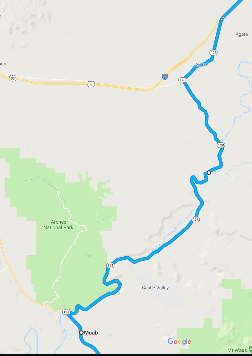
UT-128 is a two-lane twisty road without any shoulders but does have turn-outs along the way. The scenery is beautiful running along the Colorado River. Don’t get distracted and pay attention to the road in front of you.
At the end of UT-128, you can get to I-70 by turning right or left. Left is about 2 miles from I-70. The Google Map takes you to the right for about 7 miles to Cisco Landing. Cisco appears to be a ghost town along the railway. The road to Cisco has no shoulders and is wavy. No potholes but you should slow down due to the road condition.
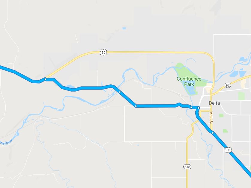
Highway 50 coming out of Grand Junction is a clean and open road. When you approach Delta, CO the google map route takes you on a shortcut/bypass into Delta, CO. It’s shorter and quicker than CO-50 even though the posted speed limited is lower.
After you get past Delta, CO you’ll drive to Montrose and take a left to Gunnison, CO. The road to Gunnison will be scenic with some high-speed sweeping turns going up and down elevated terrain (mountains/hills).
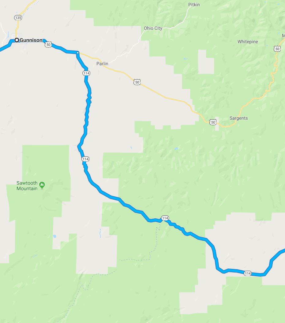
Only a few miles east of Gunnison, CO you will turn right on CO-114. Past some open areas, the next 30 miles are twisty two-lane shoulderless with great views. Again, pay attention to the road.
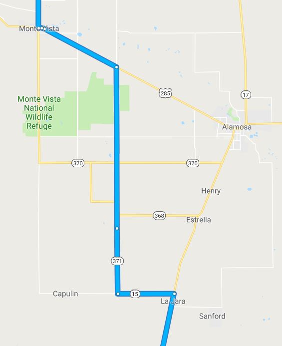
Once you get to Monte Vista, CO and turn right (east) to Alamosa, CO you’ll be guided by google maps to take CR-371. This is a shortcut around Alamosa. The road is fine with one exception. About 5 miles after the turn you will be a “Bump” warning sign. The bump is actually about a 5-6 foot section of the road that is tight gravel instead of asphalt. This shouldn’t present a problem but definitely slow down.
The rest of the roads are very open until you hit Santa Fe, NM. It was congested when I went through but that will vary depending on the time of day.